Map of St. Croix, U.S. Virgin Islands
The St. Croix rental car didn’t come with a GPS — none of them did — and for a moment we sat there stunned, trying to remember how people navigated strange islands without directions beamed down from above. How do we find the hotel? I asked the rental counter attendant. Maps, she said, and handed us one. Everything suddenly seems so inscrutable. They were speaking our language sure, but the third-world aspect of the airport (we hadn’t even gone inside, but were herded around the side and to the front where we found the Hertz counter near the parking area) and the cacophony of a steel drum welcome band plus ecstatic reunions or bon voyages or maybe a birthday party even (I couldn’t tell which, so complete with festive costumes and colorful flower bouquets were they) made the place seem suddenly very foreign, not familiar at all. The clerk pulled out a map and drew our route to the hotel. It seemed simple enough. Remember, the map said in bold at the top, to drive on the left side of the road. The driver’s shoulder should be near the shoulder of the road.
We got in the little Suzuki, rolled down the windows, and cranked the AC (best of both worlds: cool air plus the sounds and scents of the outside). I pulled out of the parking lot and absentmindedly pulled into the right lane. A woman at the gate leaned out the back of her booth and asked us where we were going. Carambola we said and she handed us a hand-drawn map with directions. Thanks I said. Left side of the road she said.
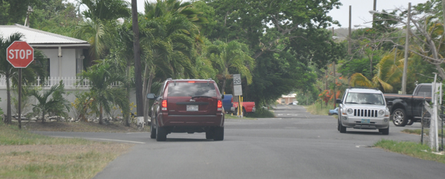
St. Croix may be a territory of the United States, but in many ways it is nothing like them.
First Example: Crucian Assumption
Crucians (the name given the 50,000 or so residents of St. Croix) give directions based on a different set of assumptions than we do in the States. For example, if I say take a left at the third light onto Main and then at the second light take a right, I mean that you ought to take the first left on the first road, and then at the second light on Main you would take a right. Rather than this first count, second count that we’re familiar with, Crucians have an ongoing count of lights. So that when the directions read take a left at the third light onto Main and a right after the fifth light, they meant take that left and then, after two lights, take a right. That threw us. But we got to drive a bit further down Center Line Rd which bisects the island almost completely, giving us a better idea of the lay of the island.
Second example: The Reluctant Guide
The hotel literature suggested that a hike to the tide pools might be worthwhile. This was seconded by the St. Croix Weekly, a publication written for tourists that we found everywhere on the island including our room. We asked the front desk clerk how to get there. He pulled out another hand-drawn map. These are the tennis courts here he said pointing at the map, after those a bridge on the right, then follow the trail. He pushed the map toward us as if it were as simple as that. But… I insisted, where are the tennis courts? He pointed out the window. I didn’t see any tennis courts. Follow the road. He said. Which road? I said. This one, he said, pointing at the map. You mean the road the golf carts drive on? I said. Yes, he said, that one. That long drawn-out drawing of water from an ostensibly dry well could have been avoided had he just pointed out the window and said take that road there past the tennis courts to the bridge. Okay, I think I’ve got it, I said. Oh yeah, how long does the trip take? An hour and a half to get there, he said. Ohhhhh. I smiled. That seems like important information. Yes, said my straight man, depending on how fast you walk.
This was turning into quite the interrogation. He must have been afraid of somehow incriminate himself. So, how’s the terrain? I asked. This part is steep, he said, pointing to about 80% of the map. The rest is easy. Wise guy.
Ever been to Yosemite? They have god-knows-how-many trails, all marked, and all mapped with difficulty levels and time estimates.
The walk only took us an hour or so each way. We found the tennis courts, and the bridge actually had a sign that said Tide Pools, but the rest was unmarked (ok, not entirely true — one of two turns we took did have a white rag tied to a tree near it), treacherous, steep, and hot as hell. But the best part, the part they forgot to tell us about, was that the last ten minute leg of the trip required that you remove your shoes and, starting in knee-deep water, waves crashing into you all the while, climb over somewhat sheer rock surfaces to get to the pools tucked into the mountain edge. I’m not a huge sissy, but my wife is somewhat pregnant. Plus the two cameras I brought? And the bag? And the snorkel and flippers? And my shoes around my neck? And we’re barefoot? Given all these factors I would put the difficulty level at a solid 8, which warrants, in my humble opinion, at least a mention from our guide.
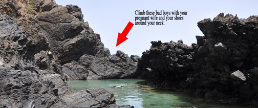
We passed what must have been an expedition from a kids’ summer day camp on the way. Fifty-plus kids with three or four adults shepherding them along the trail. They were crazy to take those kids through there. Surely they lost at least one to the steep drop offs, or the places where the trail had collapsed down the hill. You miss one step and you won’t stop rolling for a good fifty feet at least, if you’re lucky enough to be able to grab one of the saplings or vines along the way. And here’s the saddest part of the story: after that hourlong walk, all those kids were allowed was to stand on the shore for half and hour. No swimming. No relief or reward after that life-threatening hike except for a view and the sound of the waves. They didn’t try to climb into the tide pools like we had (heaven-forbid they had), they just played there on the beach in the sun, in long pants and collar shirts, skipping stones into the surf.
Third example: unmarked and unmapped
Out for an exploratory drive, we decided to head toward the sole lighthouse on the island. Depending on which map you consulted, State Highway 63 would take you along the west coast of the island and get you there (other maps showed that the road ended before the lighthouse). State Highway 63 does not take you to the lighthouse. Rather, it ends abruptly at the gates of a cement plant.
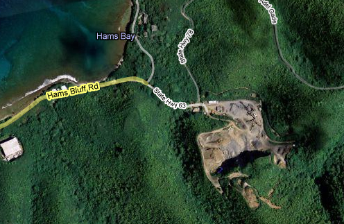
So we stopped and stared at the gates of this plant. Maybe it’s a temporary part of road construction project, like you see sometimes erected alongside big projects in the States. So do we drive through to get to the road on the other side? No, they wouldn’t have gates if that were true. That’s the best part of traveling that moment there. Trying to overlay the map of our experience and understanding onto an unfamiliar culture and terrain. Do they match up? Is this what I know from back home or something completely unfamiliar? To the left was a two-track, unmarked, that curved up and around into the forest. In the map above, you can see it clearly labeled State Highway 78. This has to be a joke. A highway is a main road. A connector. It is marked. This was an unmarked dirt path with two ruts for wheels to follow. We didn’t ever see the turn-off for the scenic route we had wanted to eventually attempt to take to get home (I say attempt because all the maps recommended four-wheel drive for these roads) so maybe this was that road. On the other hand, maybe it was someone’s driveway. We took it to find out. After half an hour of extremely bumpy but not necessarily 4×4-only terrain we began to feel that it was safe to assume that it might be the scenic route we had originally wanted.
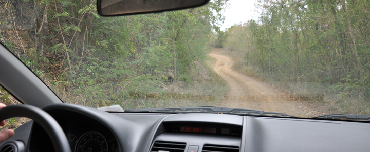
How could we know?
Along this road we passed dozens of (unmarked of course) barely cleared turnoffs. In some of the better view photos we took later you can see some of these many trails that snake through the forest and connect to one another.

Who had made these roads and why? What purpose did it serve other than offering a scenic view (somewhat scenic that is — the trees grew high on each side, obstructing all but the most famous views). Obviously some machine had to cut them out of the mountains and a good view didn’t seem to warrant so much expense and trouble. They clearly weren’t faster than taking a longer main road. Were they left over from the original cane farming and converted to recreational use? It’s a mystery.
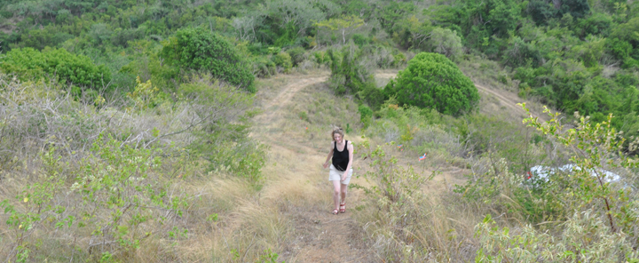
National and State parks in the U.S. clearly let you know what to expect. If they don’t fence you in (or out) and prohibit you from getting too close to perils they at least warn you clearly brightly and loudly of possible dangers and difficulties. Lots of fences. Lots of signs. St. Croix is short on signs and bereft of fences. Even if it had a fence that fence would have been toppled and the trail run through it. And it would sty that way — there wouldn’t be anyone around willing to fix it. I saw a cop drive by in the opposite direction once, but I didn’t ever see a law being enforced. Littering is punishable by a fine of up to $1000, but there was trash everywhere. Empty beer bottles dotted the roadsides plentiful as weeds. There is no open container law here, one tourist-targeted info/advert publication stated plainly, and drinking and driving in St. Croix is a way of life.
We are thoroughly policed in the U.S. We are highly directed and populated and protected and controlled. In contrast, this place truly felt like a frontier, an actual wilderness like we rarely see in the States (Highway 1 on the California coast with it’s sheer cliffs inches from the road shoulder and its cows in the road is one other place, Detroit is another — some of our old cores having become our new frontiers), especially on the scenic trails where we often encountered less than one other car an hour (a pedestrian once — miles from anywhere, a half-full 5-gallon bottle of water in his hand). Of course, anyone familiar with the area would probably feel pretty quickly like they knew the ins and outs and didn’t need the signs. After six days we felt that we had seen the grasslands and the arid region and the rain forest, driven down pretty near every main road, and been to every corner of the less-than eighty-four square miles. The map began to form and fill in in our minds.
It might begin to feel quite natural to follow common sense rather than roadside signs, a GPS, and an officer’s admonitions. Boot sense a friend calls it, common sense that comes from lived experience and a little bit of salty smarts. Boot sense comes with familiarity though, from experience, and it took six days for the place to begin to feel familiar. Prior to that, we floundered.
Example four: no script
We figured that Buck Island, a small island off the northeast cost near Christiansted would be the most tourist-infested spot and so decided to avoid it. But with all of the adventures checked off of our list and one full day remaining we asked the owner of Polly’s what we should do with our last day. Have you been to Buck Island? he asked. So we booked a tour with Big Beard’s, for the next day. The boat held over fifty but there weren’t more than twenty of us. The first segment of the tour took us to a beautiful beach where we had an hour to swim and sunbathe. The second segment was within the islands’ barrier reef. Lots of fish and coral to see, they told us. Off by ourselves, Courtney and I saw the fish, we saw the coral, we saw a lobster and a squid and then we rounded a corner and a three foot long barracuda slid in front of us all mean-eyed and toothy. It just stared at us, and we backpedalled and swam away. Are barracudas dangerous? Obviously it was a predator. Did it attack humans? How could we know?
Back on the boat we asked one of the crew. No, they leave us alone pretty much, he said. Pretty much? I asked. Well, last year a woman was sitting on the back of the boat throwing food in for the fish and kicking her feet in the water and a barracuda came up and sank its teeth into her foot and shook for a while. That was a mess. We had to take her to get stitches. So don’t feed the fish and shake your appendages as a rule. They’re also attracted to jewelry, it looks like the silversides they like to eat, so we tell people to leave that in the boat.
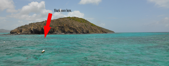
Wait. Back up. He hadn’t told us that. I had a shiny ring on, the Missus had a ring and earrings. Another girl saw a shark just now, closer in to the island, he continued with his casually spun horror fantasy where there were no consequences and life held no value. Will they eat us? I asked. Pretty much only if you have fish parts in your pockets he said, so we usually advise people to leave those behind. It was all said so nonchalantly that despite being told that we could have been barracuda snacks, it never occurred to us to skin and filet him. Like the cliffs at the tide pools, we had made it out intact, so what was the concern? A tropical cocktail of nine parts luck and one part boot sense had kept us out of harm’s way once again.
Of course, tours must prepare for tourists, who are often floundering about in total or near-total ignorance. And didn’t this company have a liability if its passengers were injured? I didn’t sign any waivers. Or wait. Did I?
I went home with more confidence in my inner GPS, and my sense of the world with some of its old-school unmediated integrity still intact, a sense of the world as an old playground with monkey bars that everyone breaks their legs on and concrete sculptures that everyone gets six stitches above their eyes from rather than a theme park with twohourlong ratmaze lines and wholly mediated fun and adventure. St. Croix, that is to say, is not at all child-proof.
We’d faced barracudas and stingrays and jungle paths and rocky cliffs and had found our own way there and back. More intrepid now in fact at four months pregnant than at any other time in our partnership, we came away feeling like we had made a new place our home, even if after six days of the humidity it will be years before I ever feel like coming back.
Reggie Hunnicutt
I just completed a file of 178 gps points of interest for St Croix. Most are street points with a few trail POIs.
ryan l
i am working in st croix for a couple months, and i must say your thoughts and experience is right on from what i have encountered so far. very amusing. i was going to venture down the scenic trail today in my rented jeep, but after about two days of rain and your comments on it… i think ill stay in and watch some tv.